South Mayo offers numerous wonderful hikes and my recent visit to the summit of Ben Creggan and Ben Gorm left a new found appreciation for the beautiful scenery of this region of Ireland.
At the start of January, I decided to make the most of a clear winter’s day and take on the walk from Glenummera valley, directly west of the Sheeffry Pass. All in all the walk was a challenging affair, but presented, in my view, one of Ireland’s most awe-inspiring views.
How high are Ben Gorm and Ben Creggan?
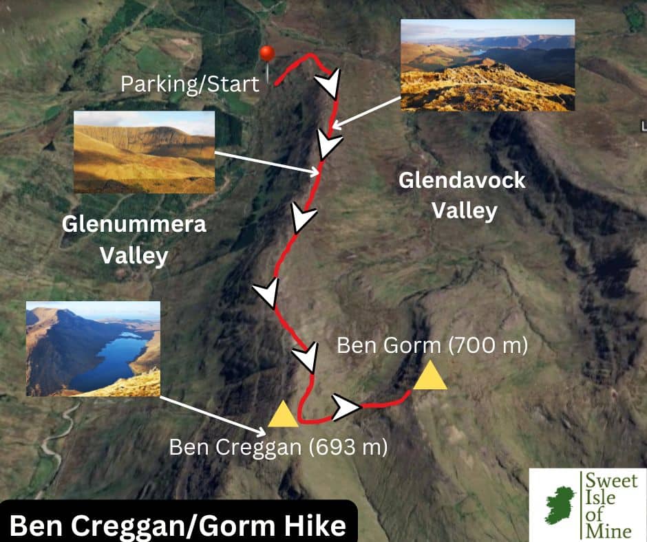
Ben Gorm (An Bhinn Ghorm) reaches a height of exactly 700 metres, while Ben Gorm South Top 687 metres. Ben Creggan (Binn an Charragáin) has an elevation of 693 metres.
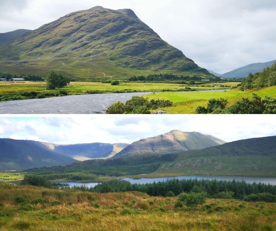
Although lower than the nearby Sheeffry Hills and Mweelrea (814 metres), visually the peaks are quite imposing, especially when viewed from Doolough.
Where are the peaks located?
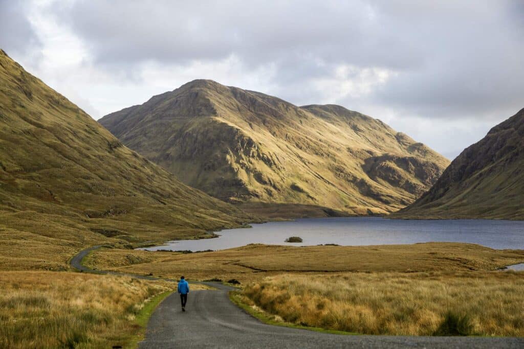
The Ben Gorm mountain group is located in south-western Mayo between several unique landscapes. To the south, it overlooks Killary Harbour, Ireland’s only fjord. To the west, Fin Lough and Doo Lough lie between Ben Gorm and the Mweelrea Mountains, forming a natural divide.
To the north, Glenummera Valley separates it from the majestic Sheeffry Hills, while to the east, the uninhabited Glendavock Valley marks the transition to lower-lying terrain.
Best Time to Hike
For optimal underfoot conditions, the hike should be carried out after a prolonged spell of dry weather, preferably during the driest months in Mayo i.e. May, June and September. You’ll be initially passing some wet, boggy ground. The higher the elevation however, the rockier it gets, making way to more solid footing. Choose a clear day with minimal winds.
During my hike in January, the initial section was steep, wet and in some spots slippery. Once reaching the ridge, this gave way to some uneven, yet manageable and drier terrain. The final section was mossy and in some spots slippery, making it imperative to have proper footwear and prior hiking experience.
An Overview of the Hike
Many take on the hike south west of Ben Gorm at the Aasleagh Falls car park. While I personally have not carried out this hike to date, many comment that the initial section before reaching the ridge is extremely boggy and wet.
We decided to start from Glenummera valley, west of Ben Creggan. Some local advice informed me that for the time of the year, this approach is less wet, more direct and would lead me to the view I’d been craving for years from the summit of Ben Creggan, that of the Mweelrea massif and Doolough Valley.
The walk took us a total of 6 hours to complete, out and back, with numerous photo stops and we enjoyed lunch with a view on the summit of Creggan. Here is a map of the walk.
What to Bring/Wear
The boggy ground and rocky slopes means you’ll need sturdy and waterproof hiking boots for the hike, especially in winter. A windproof jacket with plenty of layers underneath in the colder months is a must. I chose a down jacket with a thermal shirt and light pullover underneath, and a thin rain jacket was packed away, just in case.
I wore hiking trousers of medium thickness, which were wind and water resistant. A warm cap that covers the ears is also a necessity in the colder months. A compass is always good to have if caught in cloud and this is a very common occurrence on any mountain in the west of Ireland.
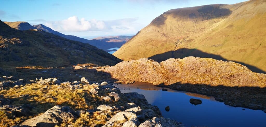
Bring plenty of water. There is a pond on the ridge and the water could be boiled and used as drinking water if planning a wild camp. On our walk, we came across no streams.
Ben Gorm & Ben Creggan Hike
Elevation Gain: 686 metres
Distance: 8.15 km (out and back)
Difficulty: Challenging
Time: 4.5 – 6 Hours
Path: No clear path, initial steep boggy section followed by rocky ridge and light scrambling near summit.
The Hike in Detail
First Section: Car to Glendavock Ridge
An icy start to the morning meant there were question marks over whether the nearby Sheeffry Pass would be drivable. We approached from the Westport side and took the right turn at Liscarney. Two locals out for their morning walk informed us the pass ‘should be grand’ and they were spot on.
As I’ve discussed the pass in detail in another article, I won’t go into much detail here but safe to say on this clear, wintery day, the scenery was magnificent. After mulling over where to park the days prior to the hike, I decided on this location in the Glenummera Valley. Park well in off the road, there is only space for 1 car.
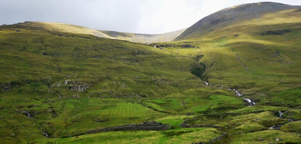
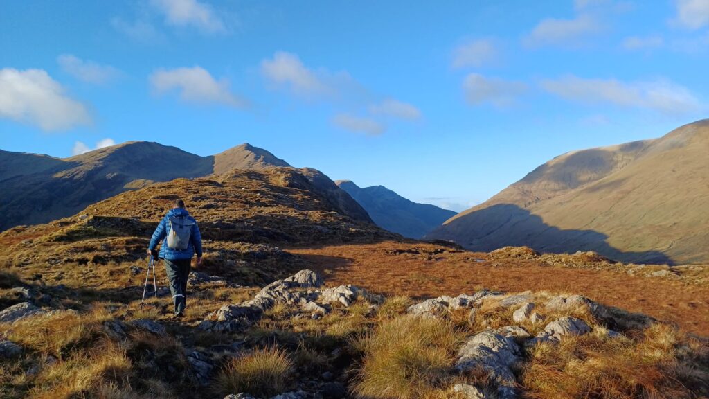
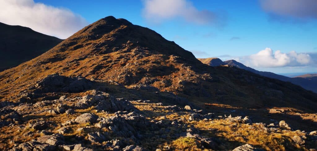
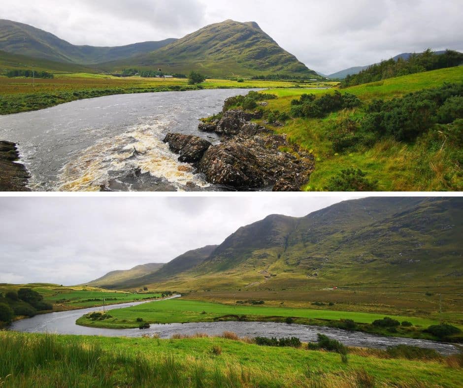
After getting out of the car, you’ll be treated to glorious valley views with the Sheeffry Hills to the north and the Glenummera river meandering its way through the valley floor. Today’s task will occupy your mind more however as you’ll have a perfect view of the ridge you will be traversing, all the way to Ben Creggan in the distance.
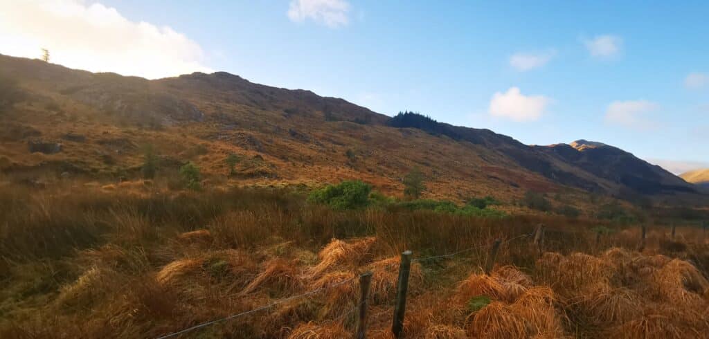
I have to say that my initial feeling was I had underestimated the length of the Glendavock ridge and this gave me a sense of urgency. So after getting the boots on, we hopped the fence and began the relatively steep ascent to the start of the ridge. Start time was 9.30 am.
You’ll initially pass some forestry and have to cross a second fence, and then it’s a mix of wet, boggy ground and large rocks. The lack of a path means you’ll have to have your head up to find the most sensible way to the top of the ridge. We took a direct approach as we were aware of the sun setting around 4 pm this time of the year. Zig-zagging your way up here would be far less strenuous during the longer days.
Second Section: Glendavock Ridge
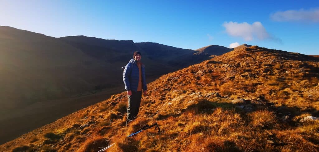
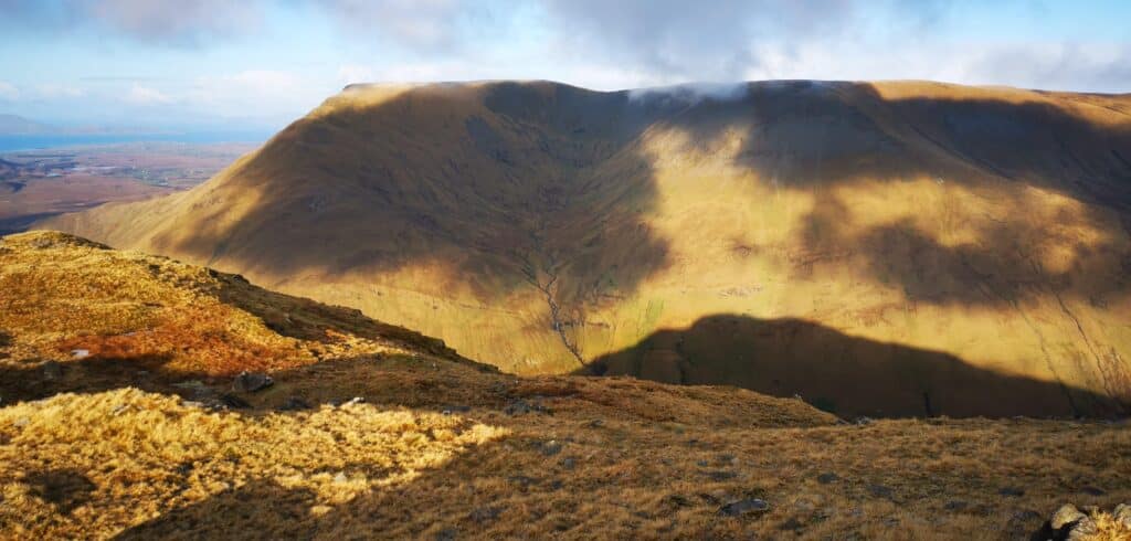
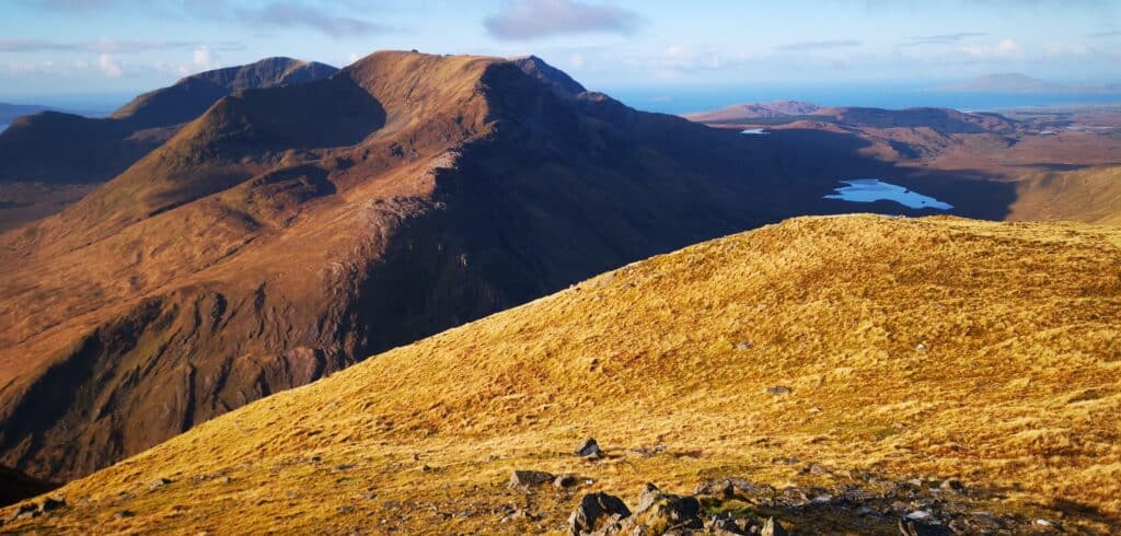
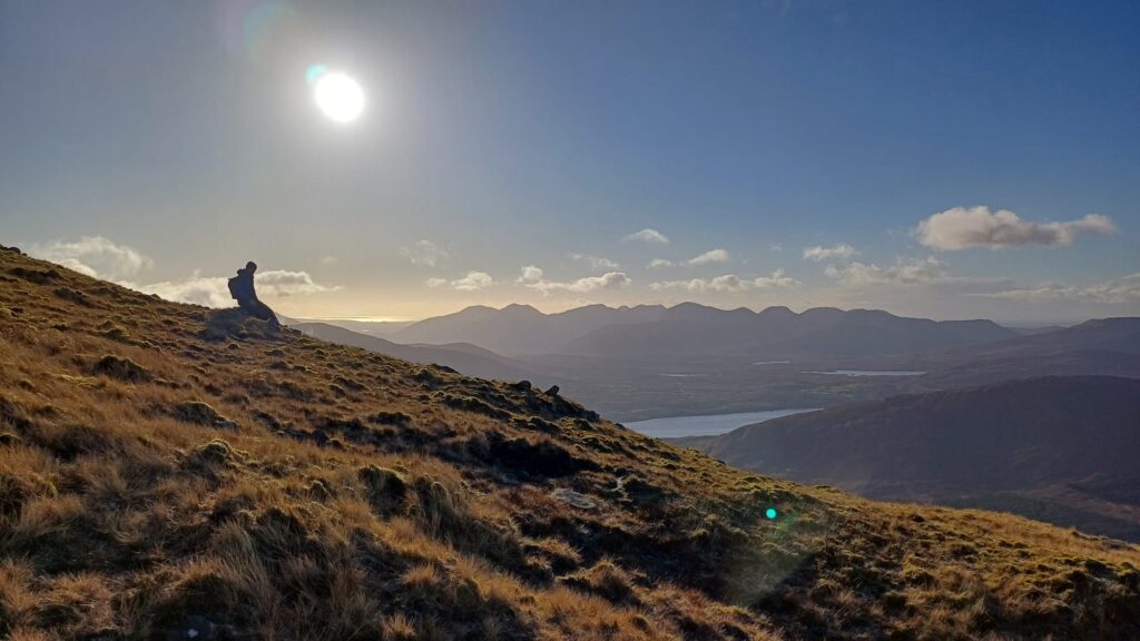
This initial section was short, no longer than 25- 30 minutes and the views were beginning to open up magnificently. After a little huffing and puffing, you’ll reach the top of the ridge. To your left the isolated, yet remarkable Glendavock Valley, to the north the spectacular Sheeffry range, with Barrclashcame dominating, and straight ahead the whole ridge line to the distant peaks of Ben Greggan and Ben Gorm.
I was amazed at how warm it was on the ridge, especially as the initial slopes during the ascent were in the shade. The jacket came off and from here on in for the next 2 km westwards the going was relatively easy, with some jagged rocks and boggy ground to navigate.
Caution!! Approximately 2 km into the ridge walk, I came across an open fault line. The cracks are scattered along the central portion of the ridge but one notable one appeared to be at least 15 feet deep (potentially far deeper) My initial thoughts were this could be lethal if there is a cover of snow in the ground or in foggy conditions.
Third Section: Final Ascent to Ben Creggan and Ben Gorm
Finally you’ll get to the business end of the hike and as there is no path along the final steeper section, it’s important to eye up your route and stick to it. We did not use any app of map of any kind here, just some common sense! We decided to approach slightly to the right of the slope, then veering left and scrambled our way along the rockier parts.
Our reasoning for this was based on the fact that underfoot was now beginning to be quite mossy, and as the ground was thawing from the previous night’s frost, it was extremely slippery. Sticking to the rocks proved a little more challenging but overall felt far more secure.
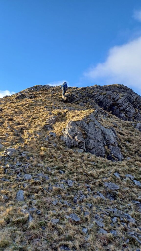
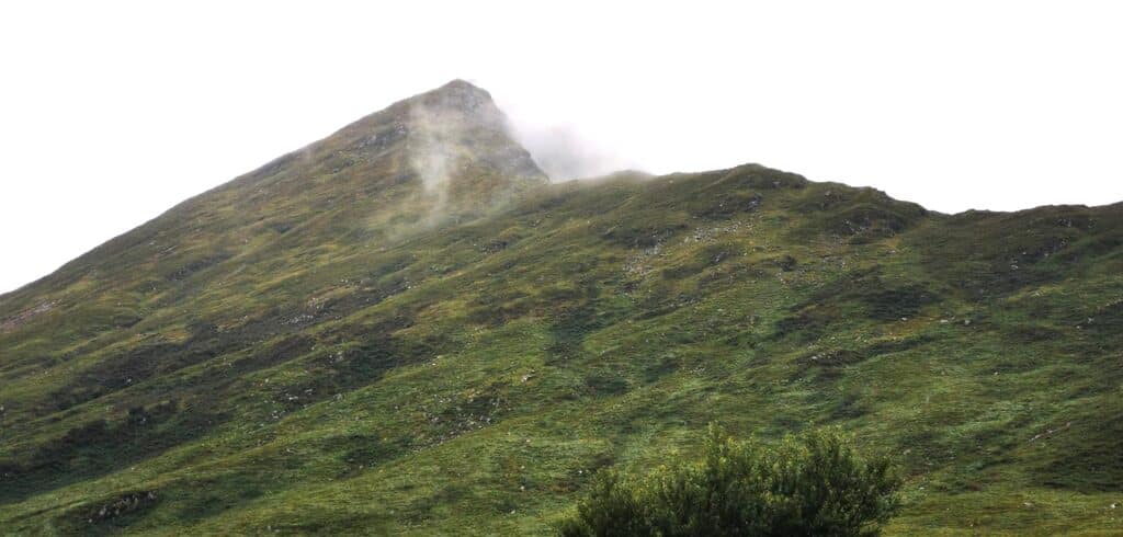
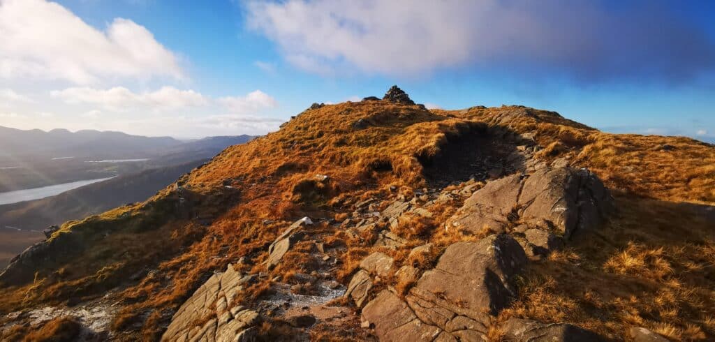
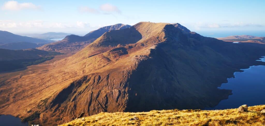
You’ll reach a couple of false summits, which proved to be the most mentally challenging part of the day! The ascent continues sharply and the views towards Doolough and Mweelrea present incredible views. Finally you’ll reach the summit cairn and the final sharp scramble will be quickly forgotten about.
From the summit you’ll easily see the summit of Ben Gorm to the south. There is a descent of approximately 100 metres to the coll before a sharp ascent of roughly the same elevation to the summit of Ben Gorm. We tapped the summit cairn here and quickly made our way to the highlight of today’s hike.
Fascinating Fact: In 2016 a local hillwalker came across the skeletal remains of up to 10 persons dating back to the Neolithic period (3,600 BC) The bones were found inside one of the fault lines commonly found on the slopes of Ben Gorm and Ben Creggan.
Magnificent Views Await
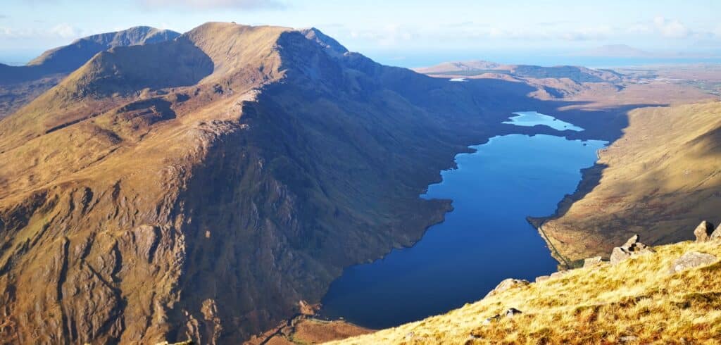
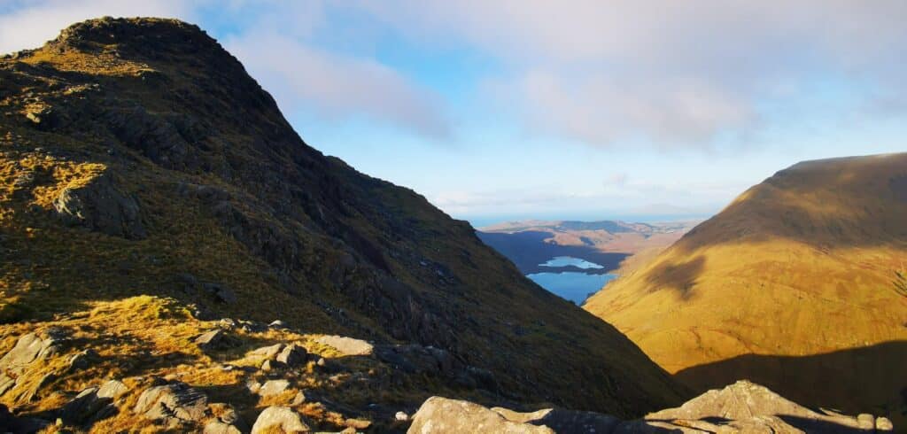
After backtracking to Creggan, we made our way westwards away from the summit cairn. Walk no more than 100 metres downslope (after this distance you’ll notice the terrain drops off here at an alarming rate!) Then we were treated to a view that must be one of the most magnificent in Ireland.
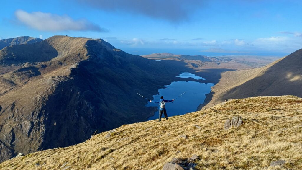
Directly below, the moody Doolough is backed to the southwest by cliffs almost 700 metres in height, dropping almost straight off Ben Lugmore (803 metres) Behind this to the west, Mayo and Connaught’s highest peak, Mweelrea stands majestically.
Sidenote: If there were ever a location to showcase the impact of the ice age on Ireland’s terrain, this specific viewpoint would surpass any geography lesson or lecture!
Out to the northwest, Clare Island and the Mayo coast with its numerous beaches, bays and headlands are in full view. To the north admire the peak of Barrclashcame (772 metres) and the Sheeffry Hill massif, with the numerous waterfalls scouring down its slopes (which incidentally we could hear during the entirety of the hike)
Then turning around to the south you’ll see Killary fjord snaking its way inland and the 12 Bens of Connemara can be counted with ease! On the Galway side, the beaches of Glassilaun and Lettergesh are easily seen. We found a nice flat rock, got out the tea and sandwiches and sat enjoying the sound of silence.
We then came to the conclusion that Mayo (and indeed Galway) are sadly far too overlooked as hiking destinations. While more popular locations such as Carrauntoohil will inevitably attract all the attention, you won’t get the serenity and isolation of this pocket of Ireland.
Added to this, the sheer variety of natural landforms visible is astounding. From Killary Fjord to mountain ranges in all directions, white sandy beaches and offshore islands, deep glacial lakes and countless lakes of Connemara, the views are unrivalled.
Being conscious of the short winter days, we very, very hesitantly began our way down and made a promise to return again over the next months.
The Descent

As this was an out and back hike, the descent was navigationally a very straight forward affair. In saying this there were a few minor slips here and there, due to the soggy, ground. Nothing alarming but my set of walking poles were a treat here.
Once again, be aware of the open fault lines on your descent as well as any loose rocks. I felt the descent quite long, especially along the whole ridge. The uneven nature of the ground along with the over-indulgence associated with the Christmas holidays certainly didn’t help!
We arrived back at the car at approximately 3.30 pm. I will comment that the very last steep section was an absolute pain, due to to the soggy ground and fading leg muscles. All in all though, a memorable day and a hike well up there with any I have completed to date.
Where to Stay Nearby
This part of Ireland is idea for a hiking holiday as there are numerous ranges in the vicinity. The nearest village of note is Leenaun, which offers a good selection of accommodation. It’s also home to some classic rural Irish pubs and has a reputation for great seafood. Have a look here for more details.
The nearest large settlement is Westport, which does offer a wide range of hotels, guesthouses and self catering. It’s a fantastic base for exploring the whole of Mayo and Connemara. Accommodation options in one of Ireland’s most charming towns can be found here.
Nearby Attractions/Things to Do
Croagh Patrick, Ireland’s most visited mountain is only 30 minutes away by car and offers a great challenge with wonderful coastal views, something we recommend combining with Ben Gorm and Ben Creggan during a hiking break, as it offers a great contrast in terms of landscape. Have a look at our detailed guide to Croagh Patrick here.
Or why not tackle the magnificent Croaghaun cliffs on Achill island, the highest in Ireland? Now this is a hike with a view…
For scenic drives, you can’t go wrong with the Sheeffry Pass, which you will pass if approaching from the Westport side. We have covered this drive in great detail here, which brings you on an extended drive through the mountains, lakes and valleys of south Mayo/Connemara.
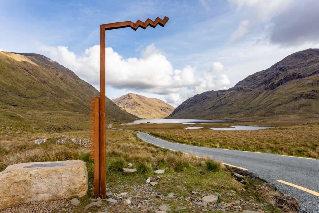
Another nearby scenic drive is through the Doolough Valley, one we cannot recommend enough. The drive, albeit beautiful, also holds a dark history, making for a poignant experience. Have a look at our guide to Doolough here.
Should you be basing yourself in county Mayo, we have an extensive list of activities and attractions listed here.
Other Hikes in the Region
Croaghaun Cliffs, Achill Island
FAQs
How long is the hike up Ben Creggan and Ben Gorm?
From the Glenummera side, it’s a total distance of 8.15 km out and back, with a time of 5 to 6 hours
Is the Ben Creggan and Ben Gorm a difficult hike?
The initial section is steep but short, followed by a moderate climb along the ridge. Some open fault lines are found here, which may be treacherous in snow. The final section requires care as its is rocky and steep and there is no defined path.
Where can you get the best view of Doolough Valley?
Doolough Valley, while stunning from the ground, is best admired from the tops of the surrounding mountains. Ben Creggan offers the most breathtaking vista of the region and is one of Ireland’s finest scenic viewpoints.