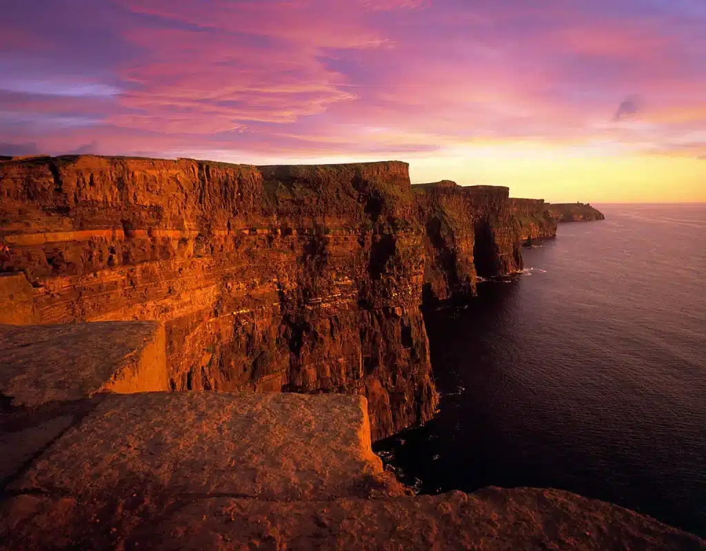
Ireland’s west coast possesses a vast array of spectacular sea cliffs, but where exactly can we find the highest?
To come up with an answer to this often-asked question, we have looked into this in great detail, and have come up with the first (& only) list of Ireland’s top 5 highest sea cliffs.
Normally, a factual list like this should be a pretty straight forward affair, but lo and behold, there have been…’disagreements’ about which lay claim to being the highest…
We’ll get to that a little later, but first, let’s address the commonly asked question,
‘Are the Cliffs of Moher the highest cliffs in Ireland?’
No, they are not. Actually, they are well off the mark. Standing proudly at 214 metres (702 feet) on the west coast of Clare, they sure are a sight to behold. Over 1 million annual tourists believe the same as they are Ireland’s most visited natural attraction.

But compared to Ireland’s highest, they are dwarfed. That certainly does not mean you shouldn’t visit. They are magnificent. I have yet to meet anyone who has said they regretted visiting them, even with all the crowds they get.
Where can you find the most beautiful cliffs in Ireland?
The Atlantic seaboard i.e. along the west coast is home to spectacular cliff scenery. Most of Ireland’s main mountain ranges are located on the west coast and after years and years of erosion, the western slopes of many of these mountains have been ‘carved’ into cliff faces.
There are also certain ‘hotspots’ which have a high concentration of sea cliffs, and these locations provide some of the best coastal hiking you’ll find anywhere in the world. Here are the best locations to go ‘cliff-spotting’ in Ireland:
- Western Iveragh Peninsula, County Kerry (near Portmagee)
- North-west of Mt. Brandon on the Dingle Peninsula, County Kerry
- West coast of County Clare
- Western Achill Island
- North Mayo (the whole 50 km stretch from Carrowteigue to Downpatrick Head)
- South-west Donegal (from Slieve League around the headland to Maghera Beach)
So for those of you wishing to visit Ireland to witness its infamous cliffs, we recommend visiting these locations above. However, it must be said that most of these locations are very remote and experience with cross-country trekking, a head for heights and good weather are all vital!
Safety First!
When visiting Irish cliffs (or any cliffs for that matter) it’s of upmost importance to stay well clear from the edges. The West of Ireland is notorious for high winds, along with changeable weather. Only ever attempt a cliff walk when the weather is calm and clear.
Those with a fear of heights should be very conscious of the massive drops all of these cliffs possess. Cliffs are also being constantly eroded so they are unstable. Some good ol’ common sense goes a long way!
What are the 5 highest cliffs in Ireland?
After scouring various maps online and with the help of Ordnance Survey maps, we were surprised with the findings. Most are completely unknown (even to Irish people)
Here are Ireland’s 5 highest cliffs:
5. Sauce Creek, County Kerry (390 metres/1,280 feet)

A beautifully shaped ‘amphitheatre’ like cliff face located on the Dingle Peninsula, Sauce Creek got its name from the Irish word ‘sás’. This can be translated into ‘trap’, which relates to the dangerous currents found in the bay below the cliffs, making it tricky for boats to leave the cove.
At almost 400 metres in height , they are Kerry’s second highest cliff and due to their remote location make them relatively unknown. Nearby, you’ll find remnants of stone goat enclosures and the fences along the cliff are not to be crossed for safety purposes.
There are numerous warnings stating this cliff is dangerous so stay well back from the edge.
How to get there
You’ll have to make your way by car to Brandon Point and park here. From here it is regarded as a challenging hike and highly recommended only in good, calm weather. Out and back will take the best part of 4 hours (12 km)
It’s also possible to start from the small village of Teer. There is a small parking area for only a few cars here.
4. Knockmore, Clare Island, County Mayo (420 metres/1,378 feet)
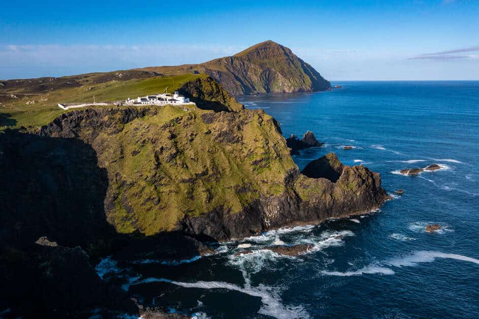
The highest point on beautiful Clare Island, Knockmore is recognisable from multiple places in the Clew Bay area. Its shape from a distance almost resembles a whale’s back rising out of the ocean. The mountain is 462 metres in height with the cliffs on the northern side rising to about 420 metres.
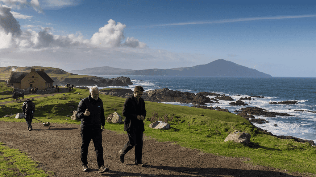
You’ll get a mighty view of these enormous cliffs from the Atlantic Drive near Mulranny/Achill and the cliffs appeared on the backdrop of the pub scenes of the Banshees of Inisherin (at Cloughmore)
Another fabulous vantage point of the cliffs of Knockmore is from Clare Island lighthouse, where you’ll get to witness, in my view, one of the most spectacular coastlines in Ireland. Here, the whole northern coast of Clare Island drops dramatically into the Atlantic below.
How to get there
First of all, you’ll have to get the boat to Clare Island, which departs from Roonagh pier daily. Details of ferry times are here. The crossing only takes about 20 minutes.
Then you better have some good hiking boots ready because you’ll have to make your way from the pier all the way to this point by foot. It is a nice easy-going road walk up to this point.
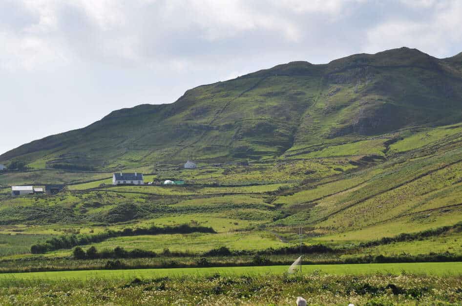
At this point you’ll start to make your way off-road along a small path and pretty quickly you’ll be gaining elevation. When you reach the coast, the views will start to open up magnificently. Then follow the cliffs to the highest point.
This last section is quite steep and reminds me of the final push for the summit on Croaghaun. The trail then continues down the eastern side to an old signal tower and meets the road again at Toremore.
It has to be mentioned that the cliffs at Knockmore are very exposed and both prior hiking/cross country trekking experience are required, as well as a good head for heights and clear weather. Each of these requirements are necessary and of equal importance.
In total the hike is 10 km long, with an elevation gain of 485 metres and is regarded as moderate/difficult.
Overall, a massively underrated hike. These cliffs are both jaw dropping and in wonderful isolation, making them one of Ireland’s last true hidden gems.
3. Cnoc na mBristi, County Kerry (460 metres/1,509 feet)
Another spectacular cliff located on the Dingle Peninsula, Cnoc na mBristsi translates as ‘Hill of the Surf’. These cliffs are found on the northern slopes of the wonderful Brandon mountain range and you certainly won’t see them listed in any guide book.
Binn na mBan, Cnoc na mBristí agus Más an Tiompáin. Éinne ann ach mé féin, foghabhar, caoire agus an dá Phiaras pic.twitter.com/trphqluuMv
— Dáithí de Mórdha (@DDeibhinn) March 20, 2021
They drop off spectacularly from the nearby high point of Mas an Tiompain (761 metres) and fall almost vertically from a height of approximately 460 metres into the pounding Atlantic below.
The coastline in this region is grand and wild, with numerous sea stacks to be found below, such as the impressive Beennaman. The cliffs are also located near the Brandon Nature Reserve, known for its Alpine flora, heather and blanket bog.
How to get there
You can park at the trailhead for Mt Brandon at The Colony, located here. From here, go through the gate and make your way along the clear path towards the coast. You’ll gain elevation nicely here and the view behind open up beautifully.
Continue along the path for about 3 km until you eventually find yourself on the cliff edge. Be careful here as the land just drops off dangerously into the Atlantic. There are no fences here, so it is imperative you choose a clear day with little wind for your hike.
The path is part of the Dingle Way, one of Ireland’s most spectacular long trails. Continuing along the path for another 1 km or so, you’ll reach Arraglen Ogham Stone. This is an 1,500 year old grave stone with an inscription in old Irish.
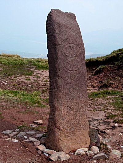
Another candidate for one of Ireland’s hidden gems, located in the magnificent mountains of the Brandon range in County Kerry.
2. Slieve League, Donegal (601 metres/1,972 feet)
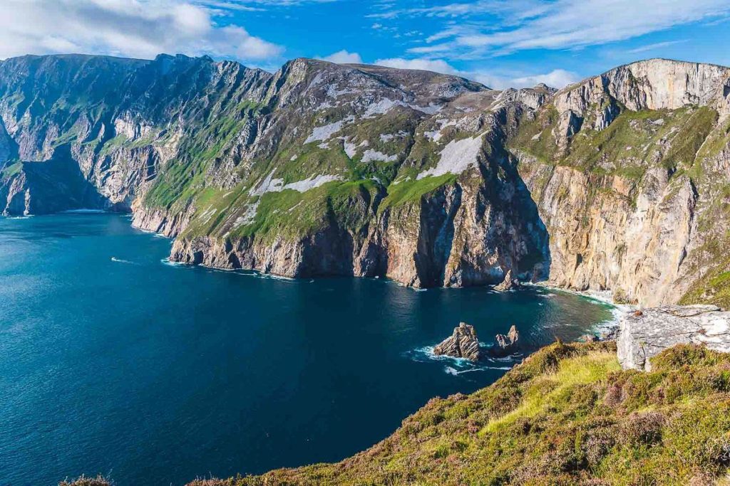
The second highest cliffs in Ireland at a height of 601 metres (1,972 feet) are the cliffs of Slieve League or in Irish ‘Sliabh Liag’, which translates as ‘Grey Mountain’. They lie in south-west County Donegal, and are regarded as one of the most spectacular coastal landscapes of Europe.
In fact, it’s safe to say that anywhere along the coast of Donegal provides outstanding scenery. From the nearby wild and wonderful ‘Murder Hole Beach’ to the Tormore Ridge on Tory Island, Donegal really seems to ‘have it all!’
A visit to Slieve League is a fantastic experience. When I personally visited for the first time, I remember just how long it took to get there from County Mayo, although on a clear day, they are clearly visible from parts of North Mayo.
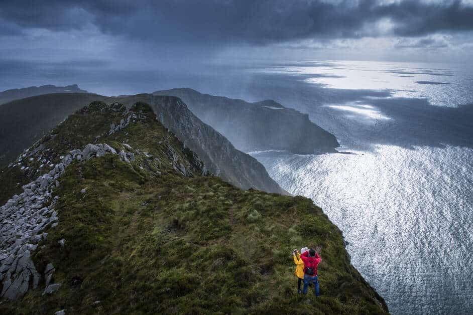
This all adds to the anticipation and by the time I got there I certainly was not disappointed. For those of you who have witnessed the magic of the Cliffs of Moher, you’ll be blown away by the sheer scale of Slieve League. Donegal’s famous cliffs reach a height 3 times higher than the famous Clare cliffs!
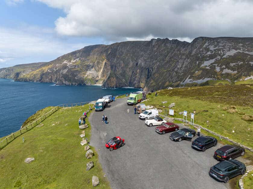
The most popular photo and view point is from Bunglass Point, located next to the upper car park. Many claim this to be one of Ireland’s most beautiful photo locations.
How to get there
If driving the Wild Atlantic Way from south to north, it takes a good hour by car from Donegal town. The nearest sizeable town is the fishing town of Killybegs, 30 minutes away. Either way the best method of transport is by car, as they are in a very remote area of Ireland.
Parking at Slieve League
There are 2 car parks, a smaller one near the viewing area (see image up above) and another approximately 30 minutes by foot away.
The first fills up very quickly and during the summer season you’ll be very lucky to get a spot here. In fact those with mobility issues will be given preference here. Your best bet is to park in the larger car park.
It is worth noting that the walk from the main car park is uphill. While not overly strenuous, it may be an issue for some. Parking costs 5 euros for 3 hours and 15 for the day. If you plan to go hiking, be aware of this.
An alternative to parking at the cliffs is by hopping on the shuttle bus, which will take you directly there. This bus departs from the Slieve League Visitor Centre and costs €6 per person (as of 2024)
Are there any hiking trails at Slieve League?
The ‘Pilgrims’ Path’ is a moderate to strenuous hike which starts in the nearby village of Teelin and takes you up behind the mountain before reaching the cliffs near ‘The One Man’s Pass’. Should only be attempted in clear conditions and under no circumstances during fog or high winds.
The fabled ‘One Man’s Pass’ continues along an almost knife-edge ridge and is reserved for those with a serious head for heights. Certainly not to be recommended during inclement weather or for those with even a hint of acrophobia!
When you arrive at the cliff top at the end of the Pilgrims’ Path, the views will take your breath away and you’ll feel you are at a far higher altitude. Coastal scenery really doesn’t get much better than this.
1. Highest Cliffs in Ireland: Croaghaun, Achill Island (688 metres/2,257 feet)
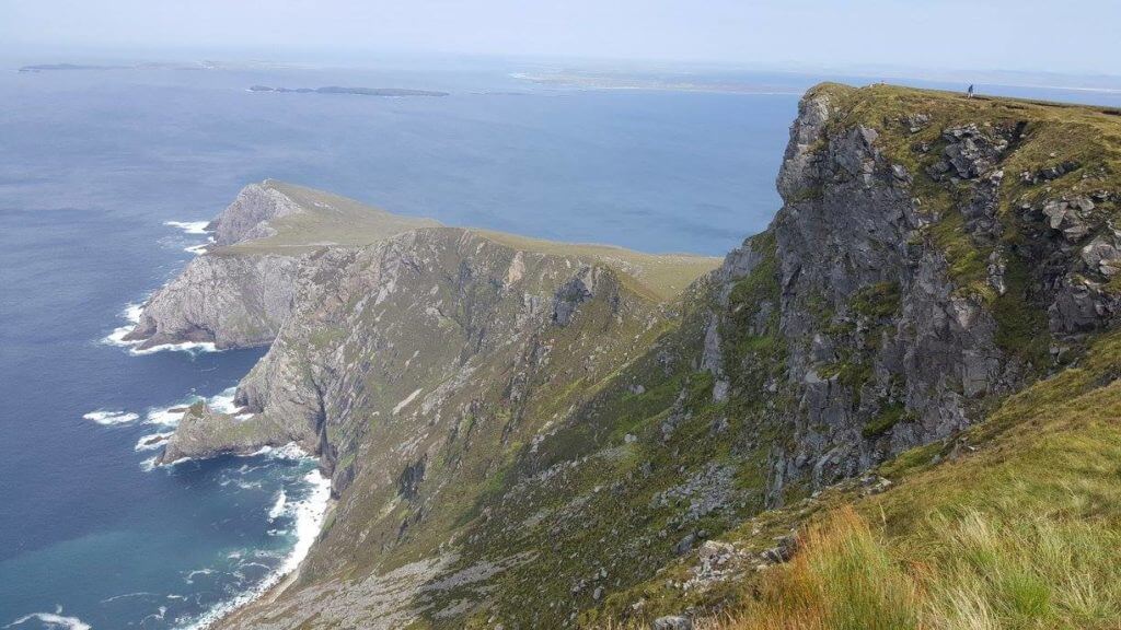
At 688 metres (2,257 feet) which is 3 times higher than the Cliffs of Moher, 87 metres higher than Slieve League and over twice the height of the Eiffel Tower, Croaghaun Sea Cliffs are without doubt Ireland’s highest cliffs.
A mountain that has been chiselled away over millennia by the power of the pounding Atlantic below, this is nature at its rawest. Standing on top of these cliffs will make you feel quite insignificant in Mother Nature’s eyes.
I have personally climbed these cliffs multiple times and although the sheer height and grandeur of the cliffs are staggering, this whole particular area of western Achill Island in County Mayo needs to be seen to be believed.
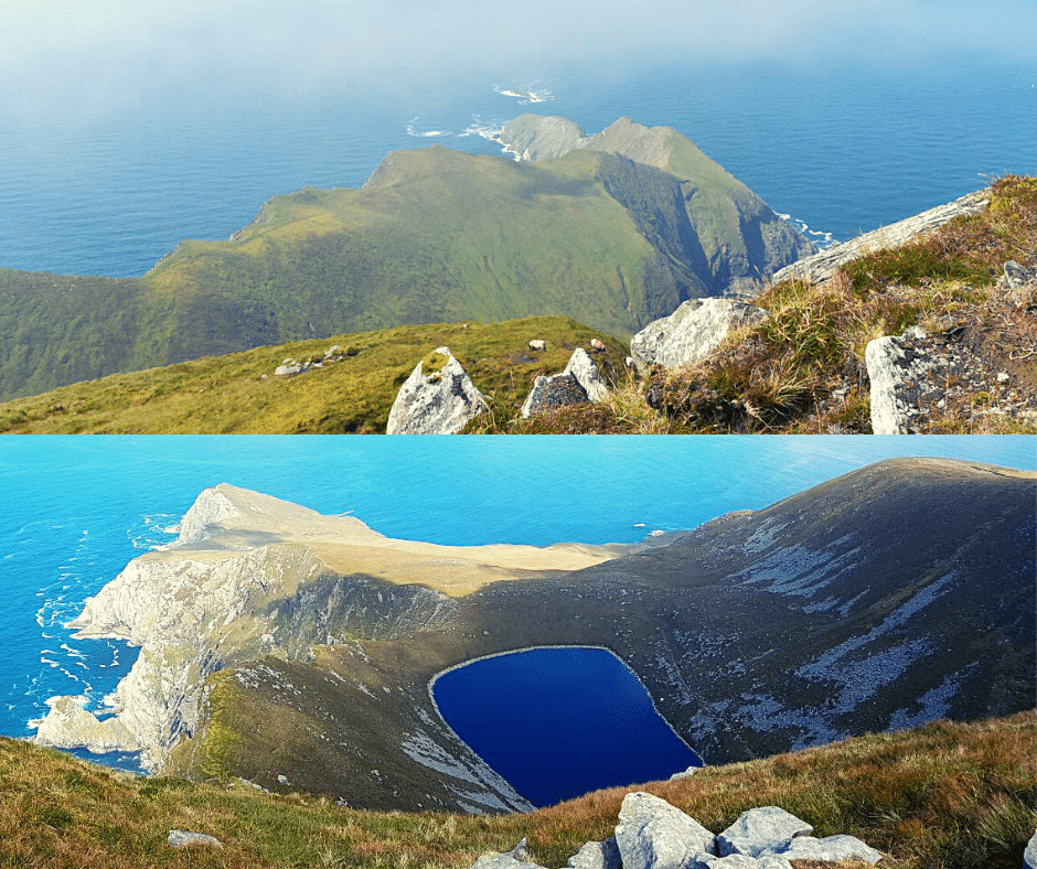
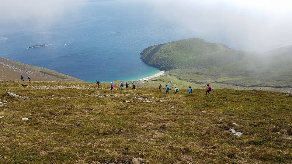
Starting from the nearby wonder beach of Keem, the cliffs start to rise to their first high point at Benmore (332 metres) and continue all the way to Achill Head. From here they rise to a height of 664 metres at Croaghaun SW Top, followed by the main peak at 688 metres.
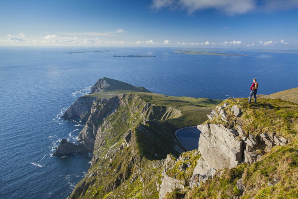
Going west from this point, it’s sheer drops 100s of metres into the ocean before reaching a dramatic end at Saddle Head. Near Saddle Head, you’ll find the impossibly impressive Bunnafreva, Ireland’s highest glacial lake, nestled perfectly under steep mountains and precariously close the the sea cliffs (see image above).
I estimate the cliffs in this region to cover an area of approximately 12 km, and funnily enough, very few have ever heard of them!

Why? Accessibility.
Until now we have looked at cliffs such as Sauce Creek and Cnoc na mBristi. Both are in incredibly remote areas and are very difficult to access. Croaghaun fits exactly into this category also, along with the added fact that it’s a difficult hike to get there.
With the Cliffs of Moher or Slieve League, it’s just a matter of driving to the viewpoint, taking your photos and knocking it off your bucket list. For Croaghaun, you’ll need to earn your views… but it’s incredibly rewarding.
How to get there
There are 2 options, either by boat or by foot.
Recently, this company has started running boat trips to the cliffs and although I have not personally done this yet, some friends of mine have and they commented that the views are so spectacular, you don’t feel like you’re in Ireland at all.
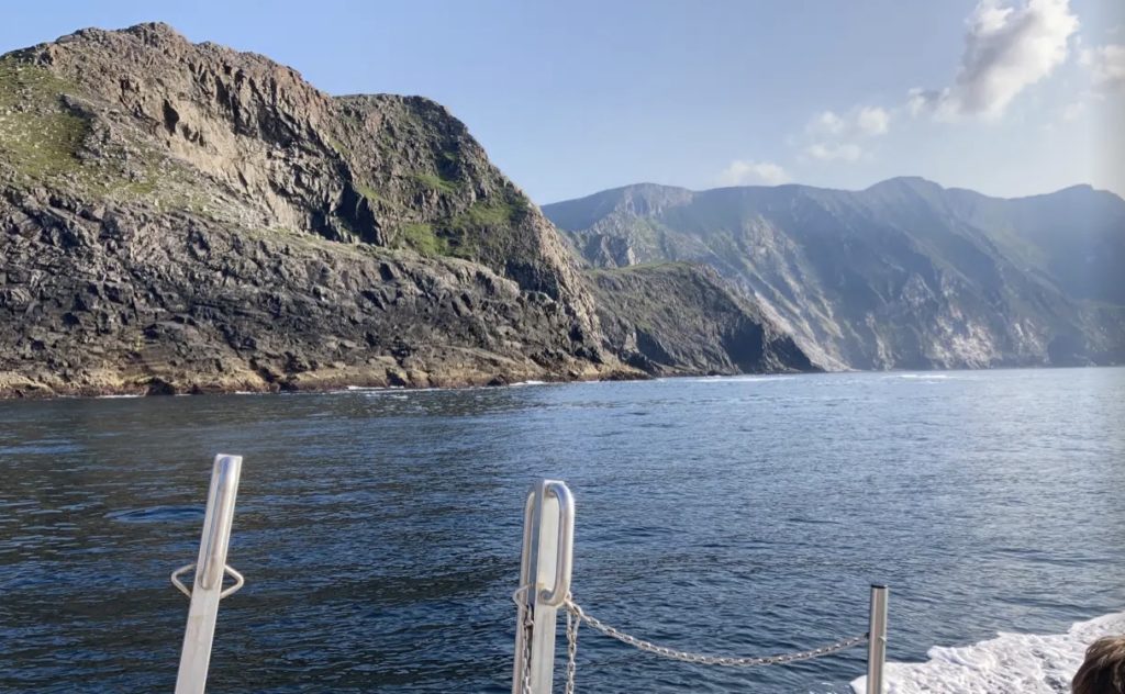
I share the same sentiments when standing on top of Croaghaun sea cliffs!
Without going into a huge amount of detail here as I have this hike covered in great detail in another article, I will say that the best place to start this hike is from Lough Accorrymore.
Many have started from Keem, but many have also turned back again, due to steepness and cliff/wind exposure. Not something you want to experience if not accustomed to cross-country trekking.
My guide to climbing Croaghaun cliffs is here.
I recommend a clear day, a great head for heights, plenty of prior hiking experience, hiking with a partner and bringing plenty of layers and supplies. I also recommend using an offline map, should you get caught in fog on these cliffs.
All in all, if you are up for this hike, we can’t recommend it highly enough. Make sure you choose a good, clear day and have some kilometres in the thighs before taking it on!
Should you be planning on visiting Achill Island, which we highly recommend, here is a list of the best things to do.
Here, you’ll find our pick of the best places to stay in Achill.
So, what’s all the fuss about? Croaghaun is clearly higher than Slieve League!
It’s a strange one…
I studied geography for 7 years so based on fact, the answer is crystal clear! For me, it’s a simple calculation: Croaghaun is 87 metres higher than Slieve League, making them Ireland’s highest cliff.
The folks at Slieve League argue that the cliffs are the highest ‘accessible’ cliffs in Ireland and also that they are the highest on the island of Ireland (Croaghaun is located on Achill Island, which is accessed via a very short bridge, but belongs to Ireland!)
While these statements are true, they are a serious case of ‘splitting hairs!’
I will say, however, that standing on both clifftops is an experience you won’t be forgetting in a hurry. Slieve League is ideal for those not willing to take on the the mighty hike to Croaghaun. Being easily accessible by car will appeal to many visitors.
For me however, the views from the summit of Croaghaun SW Top are unmatchable. Looking west, your eyes are drawn to Achill Head, almost resembling a dragon’s tail sweeping out into the Atlantic.
Looking south on a sunny day, the white sands and emerald waters of Keem beach would rival any beach in South East Asia. To the north are miles and miles or sheer drops, and to top it all off, Ireland’s highest and most unique corrie lake, Bunnafreva West.
Ireland’s Top 5 Highest Cliffs

Final Word
All in all, each and every one of Ireland’s top 5 cliffs are wonders of nature and places that make Ireland one of the world’s most beautiful countries (amongst many other reasons!)
You’ll notice that the world famous Cliffs of Moher don’t make it on the list of Ireland’s highest. Just goes to show that sometimes it pays to go off the beaten track a little and Ireland provides this opportunity in abundance.
A complete ring of Kerry is missing 14 0r so kilometres. To of the cliffs mentioned are on this route but only if you are able to hike .
Hi,
Not sure which cliffs you are referring to there. If it’s the Kerry Cliffs, they are about 300 metres in height, so don’t qualify for the top 5 highest, but sure are breathtaking!